Friday 28 February 2014

Off to Queenstown

 Up early and rarin' to go: Heather,Meaghan, Bailey & Caitlin, Susan, Cameron and Ricky.

 The  road to the top of the Crown Range - about 10 kms from where we were staying.

The view from near the top of the Crown Range. Queenstown and Lake Wakatipu in the distance. The International Airport at Frankton is also visible. 

Now down onto the Crown Terrace. Still about 2,000' ASL.

Looking down onto the countryside I traversed in the school bus as a kid.
 Truly in my home country now.

From this viewpoint on the edge of the Crown Terrace we have 7 hairpin bends to negotiate in a 720-foot decrease in altitude before we attack the last 18 kilometres of the drive to Queenstown. 

Sunday 23 February 2014


Stage Two: Waitaha Valley to Cardrona, continued
After a yummy whitebait sandwich at Haast (I think only New Zealanders know just how yummy they are), we continued on to the final destination for the day - Cardrona - about 2 hour's drive away. The intervening countryside is typical of New Zealand. Haast is at sea level and has an annual rainfall of about 143 inches, and is surrounded by temperate rain forest. Cardrona, on the other hand, is at about 2,000 feet elevation, is nestled among mountains, has a rainfall of about 20 inches, and surrounded by tussock. In between are Lakes Wanaka and Hawea. The lakes, 42 kilometres and 35 kilometres long respectively, are the remains of glaciers that occupied the area until about 10,000 years ago. The mountains on the western side of Lake Wanaka rise to 2,000 metres above sea level.

Mountains on the inland side of the Haast Pass. I always know I am getting near my heimat when I see this kind of country. 

 Lake Wanaka. 
The town of Wanaka lies in the distance at the centre of the picture.

 The Neck. 
The highway follows the eastern side of Lake Wanaka, then crosses over to the western side of Lake Hawea at The Neck. Here, the two lakes are separated by only one kilometre. 

Lake Hawea.


We finally arrived at Cardrona in the mid-afternoon and let ourselves into the house we had rented for the week. The old Cardrona Hotel, in existence since the gold rush days was only a couple of hundred metres away and proved a most salubrious spot for a meal.

Monday 17 February 2014

Stage Two: Waitaha Valley to Cardrona, continued.


It's a little difficult to remember now, that we drove from Waitaha Valley to Cardrona in one day. There is just so much to see enroute that even half a dozen blog posts on this stage would hardly do it justice.

Just south of Franz Josef there is a little village known as Fox Glacier, and if one turns right as one enters the town on the north end, and travels a further 5 kilometres, and after parking the car, one can walk a few hundred metres through the bush to Lake Matheson - yet another beautiful piece of water plonked in the Westland bush. 

 Lake Matheson

Lake Matheson

 The path to Lake Matheson

An hour's drive south of Fox Glacier we came upon Knights Point where the Lookout provided wonderful views up and down the coast. The road continued along the coast for another 15 minutes before we headed inland at Haast.

 Knights Point

Haast Bridge - about 700 metres from end to end.


Sunday 16 February 2014

Stage Two: Waitaha Valley to Cardrona, continued.

The Westland lakes are lovely, and it is hard not to take heaps of photos. Lakes Ianthe, Wahapo and Mapaurika are all alongside the highway between Pukekura and Franz Josef and it is only a matter of stopping the car anywhere along the shore for a great photo.

Lake Mapaurika

Five minute's drive south of Lake Mapaurika the little township of Franz Josef nestles under the hill, and is a popular stop-off for the many people who visit the nearby glacier. 

A further 5 kilometre drive from Franz Josef takes you to the carpark in the glacier valley, from where one can walk the c2,000 metres to near the foot of the glacier itself. On a hot day, the cold air falling off the glacier provides welcome and efficient air conditioning.
Franz Josef Glacier

A bus driver, driving across the glacial moraine on the flats south of Lake Wakatipu, was asked by one of his passengers, "Say, Driver! Where did all them boulders come from?"

"Oh, the glaciers brought them down from the hills millions of years ago," he replied.

The tourist pondered this morsel of ground-shaking information, then asked, "Say, Driver! Where have all the glaciers gone now?"

"They've gone 'way back up for another load of boulders," said the poker-faced driver.


Saturday 15 February 2014

The big guys have arrived and are ready to go on Monday morning.

Kinda makes our MF 165 tractor look a bit small. The unattached bucket holds 1.2 m³, which would take Mum and I most of the day to fill with shovels! She reckons it would take a week to fill on my own.
The river is munching its way into the farm. Every time its flow goes over about 200 cumecs, the water eats a bit more of the bank away. At least twice in the last 12 months we have experienced >1,000 cumecs, with a peak of 1,234 cumecs. 

I left the broom bushes there in the (mostly) vain hope that their roots would slow the erosion.


Fortuitously, the cavalry have arrived. Here, Tom is dropping off a few pebbles for use in stabilising the river bank. The work is timed to take advantage of the current low river levels - about normal for this time of year.

Yesterday marked three years since we moved into this house, and three years four days since we departed Fiji. My, how time flies!

Friday 14 February 2014

Stage Two: Waitaha Valley to Cardrona.
After Marty had disappeared to spread urea over the farm, we said goodbye to Trish and began the last leg to Cardrona where daughter Susan had booked a house for a week.

The first township (population 3) was Pukekura, which boasted a souvenir/coffee shop and some imported wildlife. (Note to non-New Zealand readers, there are only two mammal species native to New Zealand; two species of bat.)

 Himalayan Tahr
Hemitragus jemlahicus

 Son-in-law enjoys hunting these chaps

Red Deer stag
Cervus elaphus

There is no doubt that New Zealand is a beautiful country, especially South Island, and this was proved over and over as we traveled south. Hardly five minutes' drive south of Pukekura and there lay beautiful Lake Ianthe.
 Lake Ianthe

 Lake Ianthe

 Lake Ianthe

 Cattle yards near Whataroa River

Lake Wahapo

Thursday 13 February 2014

Stage One; Part B
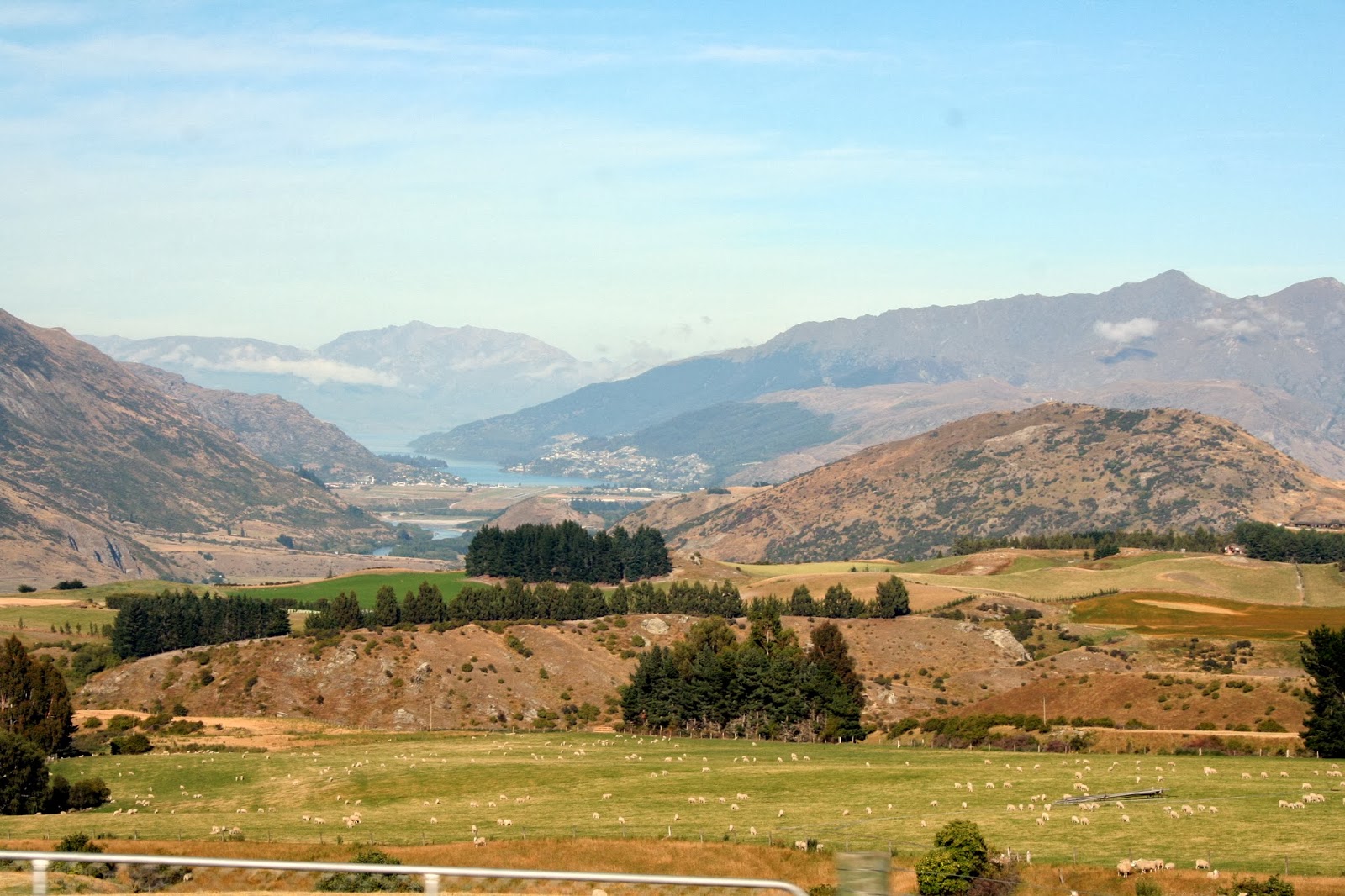
After passing through Greymouth, the birthplace of our youngest daughter, Kathryn, we motored on down to Hokitika, a small town on the coast that once hosted a thriving port.

From Wikipedia:
Founded on gold mining in 1864, it was a centre of the West Coast Gold Rush. By late 1866, it was one of New Zealand's most populous centres.
On September 16, 1867 there were 41 vessels alongside the wharf at Hokitika, in some places three and four deep. In 1867, the port of Hokitika ranked first in New Zealand in both the number of vessels entered inwards and in the total value of exports (principally gold). It became the capital of New Zealand's short-lived Westland Province from 1873 until the abolition of provinces in 1876.
The population has declined greatly since that time but the population of the Westland District is now on the rise thanks to "lifestyle inhabitants". Almost 30% of the district's rate-payers live outside of Hokitika.
The river mouth has now silted up and now only the odd brave fisherman crosses the bar.

My earliest memory of the place is of a trip with my father in Cessna 180 ZK-BFT on 27th December 1957. There, he bought me a small metholated spirits fueled steam engine for my birthday that was a few days later. I remember flying back to Queenstown sitting on the cold aluminium floor of the rear of the aircraft - the seats having been removed for carrying cargo - and the front passenger seat being occupied by Trevor Cheetham, another pioneer pilot of the Queenstown area. I recall a close inspection of the top of Mt Cook. But I digress.

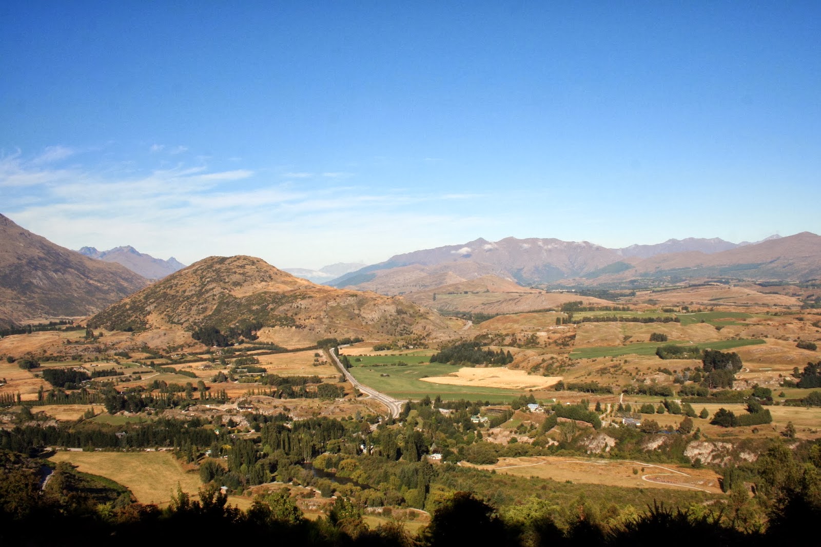
We met up with brother Marty and his partner Trish, and took a tiki tour in his car up to Lake Kanieri. We looked at a piece of land he has his eye on before returning to Hokitika where we re-mounted our traansport and followed Marty to his current abode up the Waitaha Valley. The turnoff is just north of Pukekohe. Marty is working on a farm where they milk 1,200 cows every 16 hours - not twice a day as used to be the norm.

An unusual part of the trip was crossing the Taramakau Road-Rail bridge north of Hokitika. Not many places in the world have trains and road transport sharing the same bridge!

Taramakau Road Rail Bridge

Wednesday 12 February 2014

To begin stage one of our trip south, we left home at about 07:30 and headed up the valley and crossed over the Stanleybrook, through Tapawera and hooked a right at the Kohatu pub.

At Inangahua we turned left to continue to Greymouth via Reefton. It is possible to get to Greymouth by turning right and going past Westport and down the coast. The drive down the coast from Westport is particularly beautiful, and I put up some photos of it for this portion of the trip. They were taken in August 2008.

 Pororari River at Punakaiki

 Looking south along the coast from Pancake Rocks

 Blowhole at Pancake Rocks

Pancake Rocks again. Blowhole blowing.

A walk around the Pancake Rocks is a well-worthwhile endeavour and shouldn't be missed if you're ever travelling in these parts. 
We have just returned from a trip down south to the Queenstown area with daughter Susan, her husband Ricky and their four offspring.

But, before we went, I was able to help the neighbours get their hay in. These were the conventional bales weighing 20 or 30 kilograms that are in demand by people with 'lifestyle' blocks, or have a horse to feed.

Once the hay was in, we were free to go.